Google Maps is great to get a birds eye view of your property, but it may not have the detail you need. We can provide detail in our imagery that is focused on the area that you are interested!
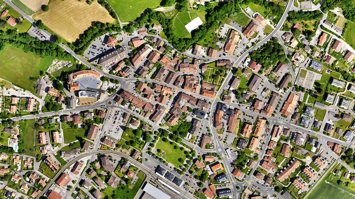
Google Maps is great to get a birds eye view of your property, but it may not have the detail you need. We can provide detail in our imagery that is focused on the area that you are interested!
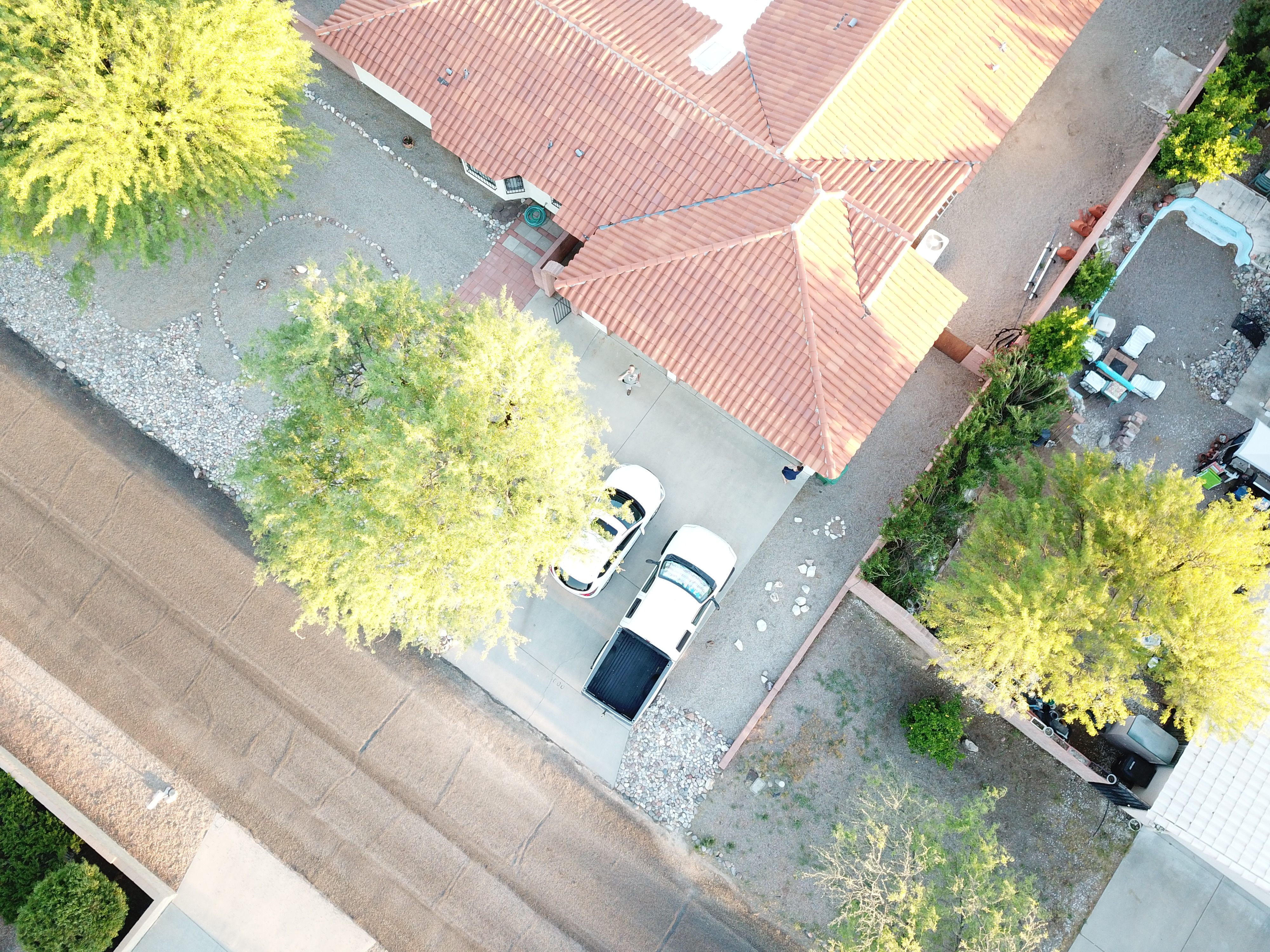
 There are many variants of photogrammetry. One example is the extraction of three-dimensional measurements from two-dimensional data (i.e. images);
for example, the distance between two points that lie on a plane parallel to the photographic image plane can be determined by measuring their distance
on the image, if the scale of the image is known. Sounds complicated, but the image to the right shows a practical example.
There are many variants of photogrammetry. One example is the extraction of three-dimensional measurements from two-dimensional data (i.e. images);
for example, the distance between two points that lie on a plane parallel to the photographic image plane can be determined by measuring their distance
on the image, if the scale of the image is known. Sounds complicated, but the image to the right shows a practical example.
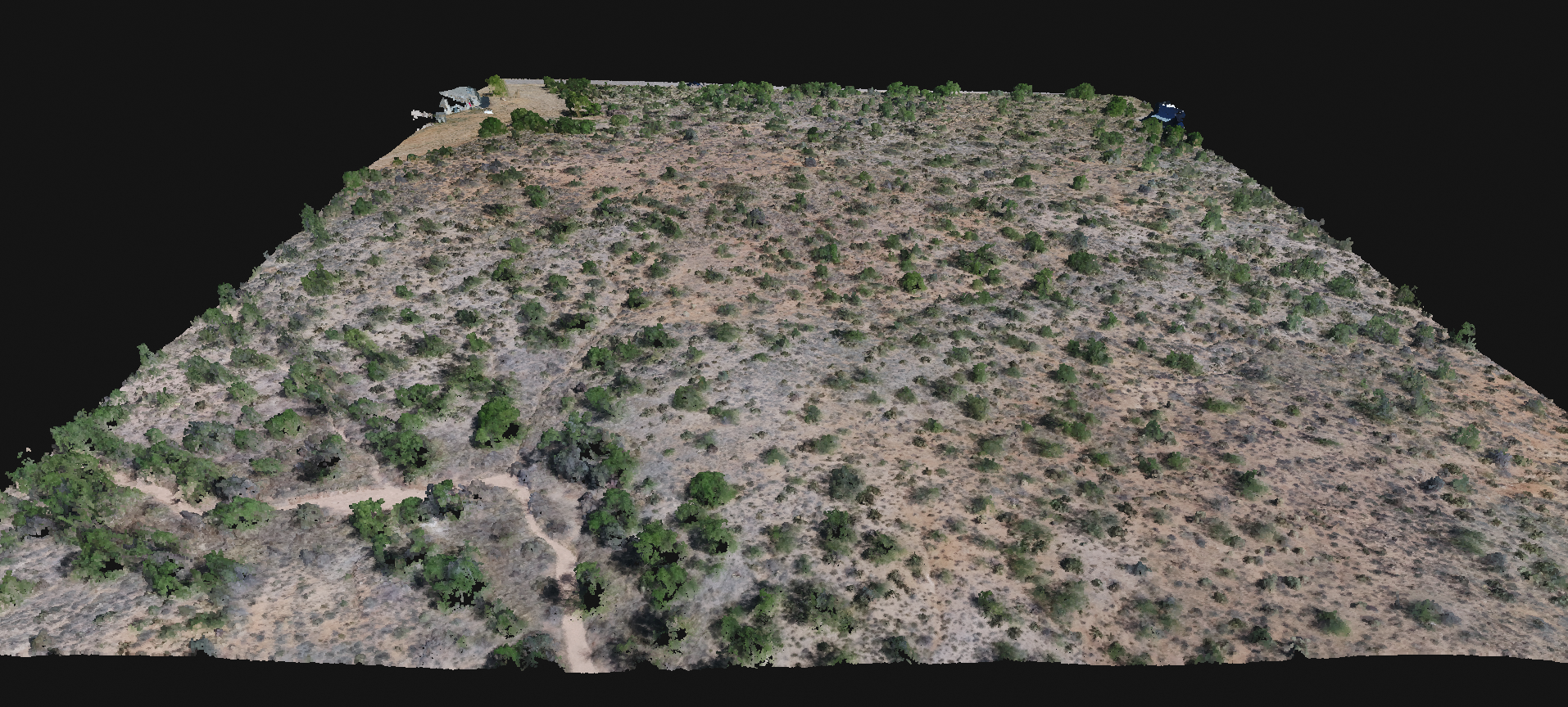
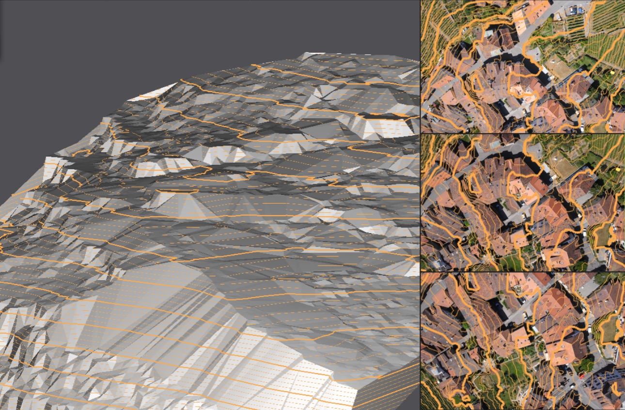 A topographic survey is typically based upon a systematic observation of points in an area, but with drones, we can collect the data much quicker
by performing a fly over. The data can than be show as a photograph or a 3D Computer model.
A topographic survey is typically based upon a systematic observation of points in an area, but with drones, we can collect the data much quicker
by performing a fly over. The data can than be show as a photograph or a 3D Computer model.